Summary
GPS tracks have to be cleansed (removing outliers) before analysis, and cleansing requires some manual editing.
For this manual editing, I searched around for a good tool. Many are available, but there's no definite winner. Here's the detailed comparison.
Note that this comparison is only for manual cleansing of large amount of GPX files. So, popular functions like photo tagging or multiple format support are out of scope. Also, since I believe GPS log is highly personal, online services, which require sending raw GPS log to servers, are excluded.
Roughly ordered by my recommendation from the left.
| GPS Track Editor | GPS Master | GPX Editor | GpsPrune | JOSM | |
|---|---|---|---|---|---|
| Tested version | 1.15.141 | 0.63.30 | 1.7.9 | 19.2 | 14620 |
| Released | 2015-08-11 | 2018-11-17 | 2018-09-12 | 2018-12-?? | 2018-12-31 |
| Written in | ? (closed source) | Java | Delphi | Java | Java |
| License | Freeware | GPL v2 | BSD | GPL v2 | GPL v2 |
| Multiple file | Yes | Yes | No (merged) | No (merged) | No (merged) |
| Background map | Yes | Yes | Not good | Yes | Yes |
| Rectangle remove | No | No | Yes | Yes | Yes |
| Charts | No | Yes | Yes | Yes | No |
Technically speaking, GPX is just an XML format, and XML is just a text file. So, you can also use any XML editor or text editor for GPX editing. They do not support map view of tracks, but can be an option sometimes.
GPS Track Editor
Though slightly older than other software, its interface is the most clean and light weight. I use this software for bulk data cleansing.
Site: http://www.gpstrackeditor.com/
[Pros]
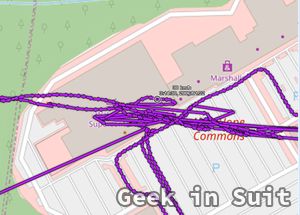
- Best presentation of tracks: arrowed segments. Though some other tools support showing arrows, only this software supports this presentation, which make eye tracing track points quite easy. Also, moving mouse to each track point shows each point's time and velocity. (image 1)
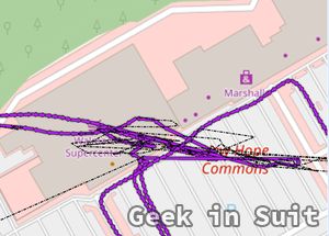
- 2-step remove. (Removed points are shown dotted, and can be reversed until actually committed) (image 2)
- Convenient "filter > local inconsistency" function for cleansing.
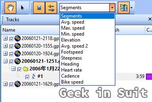
- Tracks can be colored in various ways like track number, speed, etc. (image 3)
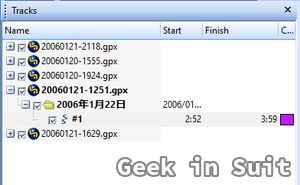
- Multiple GPX files and tracks are treated in straight-forward manner. (automatically colored, not automatically merged, etc.) (image 4)
[Cons]
- No chart function.
- No rectangle remove function.
GPS Master
Great chart functions. You can freely pick vertical and horizontal axis, though user interface needs some polishing. I use this software for viewing details of tracks to bring back travel memories.
Site: https://wiki.openstreetmap.org/wiki/GpsMaster
[Pros]
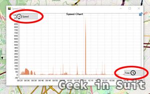
- Great chart functions. You can freely pick vertical and horizontal axis. Vertical axis options are elevation, speed, VDOP, HDOP, PDOP, VDOP, and number of satellite. Horizontal axis options are distance, time, and duration. (image 1)
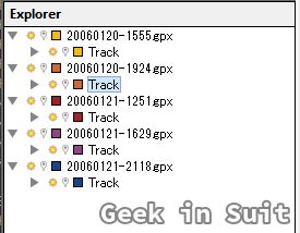
- Multiple GPX files and tracks are treated in straight-forward manner. (automatically colored, not automatically merged, etc.) (image 2)
[Cons]
- Track points are not shown. (only lines and arrows are shown.)
- No rectangle remove function.
- Multiple tracks in a single file are not automatically colored.
- User interface needs some polishing. For example, all menu items are shown in icon only and so you have to mouse over to know what the function is. (image 3) Also, moving mouse into chart area moves cursor in map area. This can be annoying especially when you are zoomed in (simple mouse move can cause map flying).
GPX Editor
This software has very powerful set of manual data editing functions. I use this software for manual data cleansing. (Due to large volume of my data, I don't do it often, though.)
Site: https://sourceforge.net/projects/gpxeditor/
[Pros]
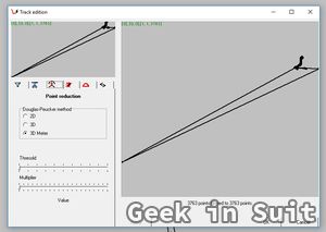
- Rich set of data cleansing functions including Douglas-Peucker algorithm (image 1), which can be invoked by clicking track segment on the left pane.
- Rectangle remove function is provided, which can be applied to a single selected track or all tracks in the rectangle.
[Cons]
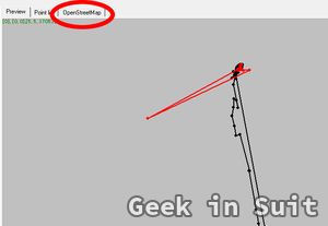
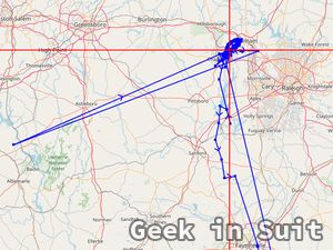
- Background map cannot be shown on track editing screen. (image 2)
- Vertical chart size cannot be changed.
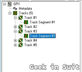
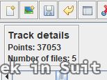
- Multiple files are merged into tracks of a single file. (image 3)
- Edit tool cannot be held. You have to go back to "Rectangle remove" button every time after each remove executed.
- Track arrows are not shown.
GpsPrune
This is the most popular GPS track editor, but not so good for manual cleansing of every track.
Site: https://activityworkshop.net/software/gpsprune/
[Pros]
- Background map supported. Lines, points and arrows presentation supported. (image 1)
- Rectangle remove is supported. (Track > Mark points in rectangle)
[Cons]
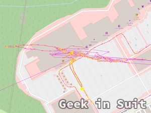
- Multiple files are merged into a single track. (image 2)
- Horizontal axis of chart cannot be changed and vertical axis cannot be set to "satellites used". (which is very helpful to find suspicious points.)
JOSM
This software is not for GPS track editing, but for the whole map editing to create OpenStreetMap. For that purpose, it has very rich features and one of them is GPX displaying. Also, EditGPX plugin adds editing functionality.
Site: https://josm.openstreetmap.de/
[Pros]
- Background map supported. Lines, points and arrows presentation supported. (image 1)
- Very actively developed for large community of OpenStreetMap mappers.
[Cons]
- Designed to edit 2D points, and so information such as elevation and satellites used is lost after editing.
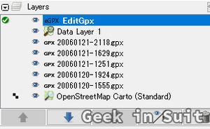
- Multiple tracks are merged into a single track when EditGPX plugin reads GPX layer. (image 2)
- No chart supported.
- No rectangle remove supported.
Others
- Viking: Its original "vik" format is default and thus GPX support is weak. Though official release is a bit old, development on GitHub seems active.
- GPXSee: Simple and handy GPX viewer. No editing functionality.
- Liquid Studio Large File Editor: Generic XML editor, which supports extremely large text file. Community edition is free.
